


By 9:19 on Saturday morning, any fantasy of an empty sunrise walk had burned off. Historic Main Street was awake. So was the heat.
I had planned to begin much earlier, but the late start changed the story in a useful way. Instead of photographing a sleeping town, I found Buford already moving: cars crossing the railroad tracks, people opening businesses, and the hard August sun settling over the brick storefronts. The humidity made every block feel longer than it looked on the map.
DD-0003 became a ground expedition in the most literal sense. I walked, stopped, cooled down, charged the phone, drank water, and went back out. The finished film follows that rhythm.
DD-0003: Buford, Georgia. Historic Main Street, the Environmental and Heritage Center, Tannery Row, the Mall of Georgia corridor, and the walk back from Fogo de Chao.
A railroad town before it was the Leather City
Buford began as a railroad town. The City of Buford’s history says the community was named for Algernon Sidney Buford, president of the Atlanta and Richmond Air-Line Railroad. The town was incorporated in 1872, then incorporated as the City of Buford in 1896.
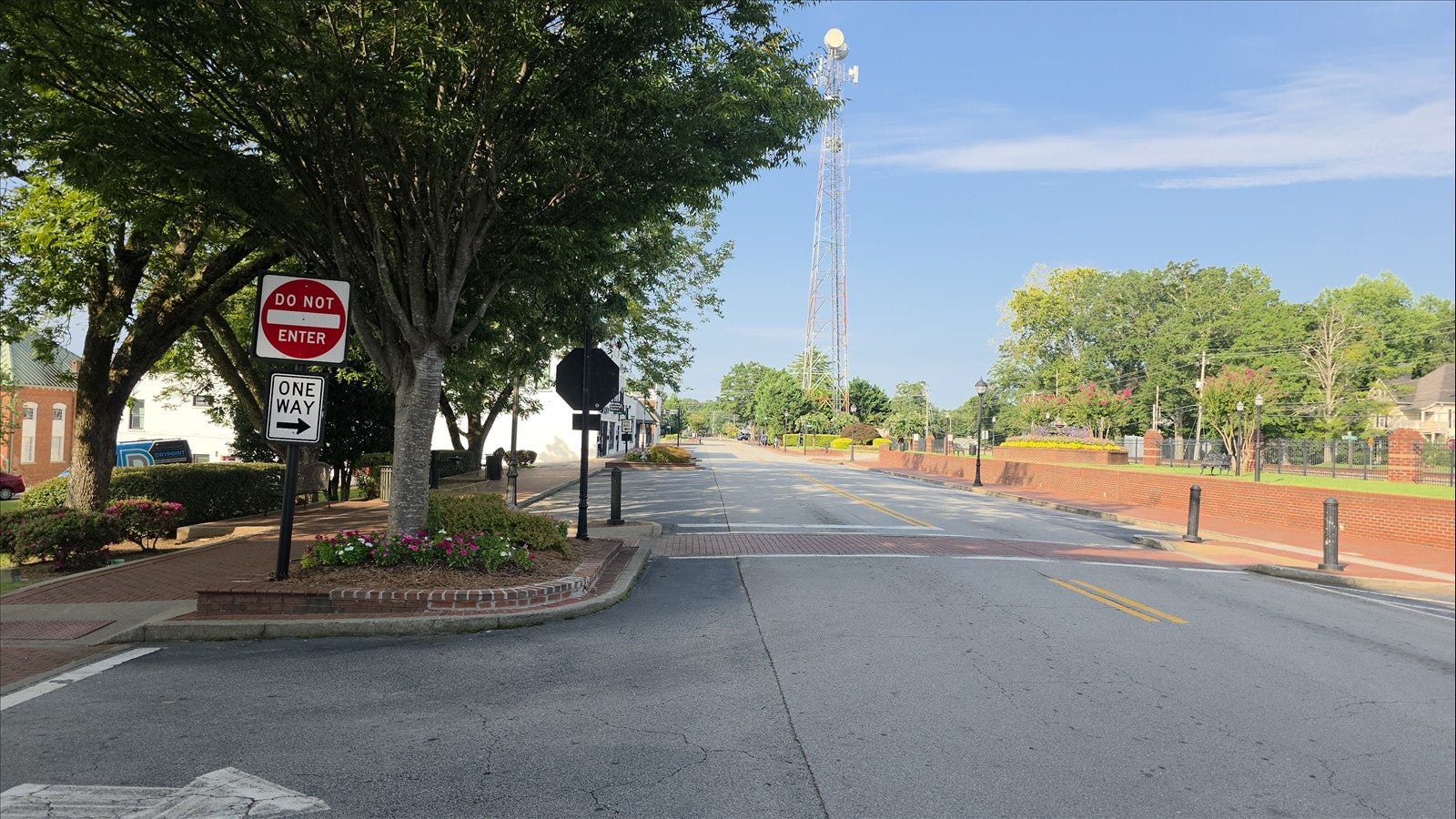
The railroad connection is still legible from Main Street. The tracks, industrial buildings, water tower, service alleys, and storefronts sit close enough together that the town’s different eras overlap in a single walk. That compression is what first caught my eye around 3 East Main Street.
Buford later became known nationally as the Leather City. Calling the operation simply “the tannery” understates its scale. The city notes that the Bona Allen companies manufactured shoes, saddles, harnesses, horse collars, and other leather products that traveled across the country and abroad. Buford was once promoted as the “New York of Gwinnett” because so much industry gathered here.
Standing on Main Street, those facts did not feel sealed away in a museum. The old working city was still visible beneath the newer restaurants, studios, and shops.
The car became base camp
The August weather shaped the expedition as much as the itinerary did. I treated the car as a small base camp: air conditioning, charging station, water stop, and recovery room between locations.
Before the route stretched into the afternoon, I stopped at QuikTrip for gas and expedition fuel. That meant four roller dogs, a liter of water, and two sugar-free BODYARMOR Flash I.V. drinks, one regular and one caffeinated. It was not elegant, but it was practical. I finished the non-caffeinated bottle first and kept drinking water throughout the day.
The pauses mattered. Heat makes it easy to rush, lose concentration, or mistake stubbornness for productivity. Cooling down gave me enough attention to notice the smaller things when I stepped back outside: a faded wall, a service entrance, the space between two buildings, or the way the railroad divided the street.
A detour into Gwinnett’s environmental memory
Tannery Row did not open until noon, so I used the gap for a compact detour to the Gwinnett Environmental and Heritage Center.
I started outside and walked a couple of trails. By the time I returned to the car around 11:34, the humidity had done its work. I cooled down, checked the admission question, and learned that the center itself was free. So I went back inside with the camera instead of leaving.
The interior was smaller than I expected, but it connected water, land use, ecology, and local development in a way that made the outdoor walk feel more deliberate. According to Gwinnett County, the center sits on 233 wooded acres with five miles of trails. Its building was the county’s first LEED-certified project and uses features such as pervious pavement, a green roof, and water-focused exhibits.
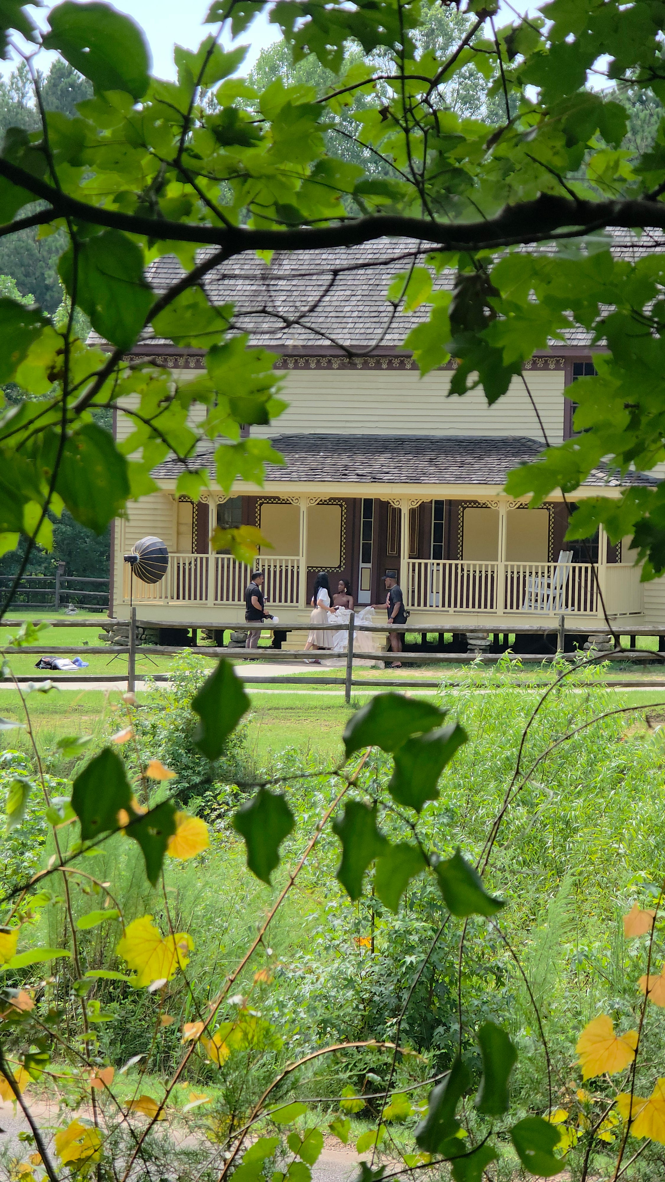
The strongest historical surprise was the Chesser-Williams House. The 1850s dwelling is a two-story I-house, a form defined by its narrow one-room depth. Inside are surviving examples of painted and stenciled decoration attributed to a traveling German artist who exchanged his work for room and board. The Williams family donated the house in 2008, and the county relocated it six miles to the Heritage Center campus so it could be preserved.
It is one thing to read that Buford changed from farms and workshops into an industrial city. It is another to stand inside a house that survived from the earlier landscape.
The shoe factory that kept working
At noon I returned to town for Tannery Row Artist Colony. The former Bona Allen shoe factory is exactly the kind of place that rewards a slow camera. Its exterior carries the mass of an industrial building, while the interior breaks into corridors, doorways, studios, paintings, and working surfaces.
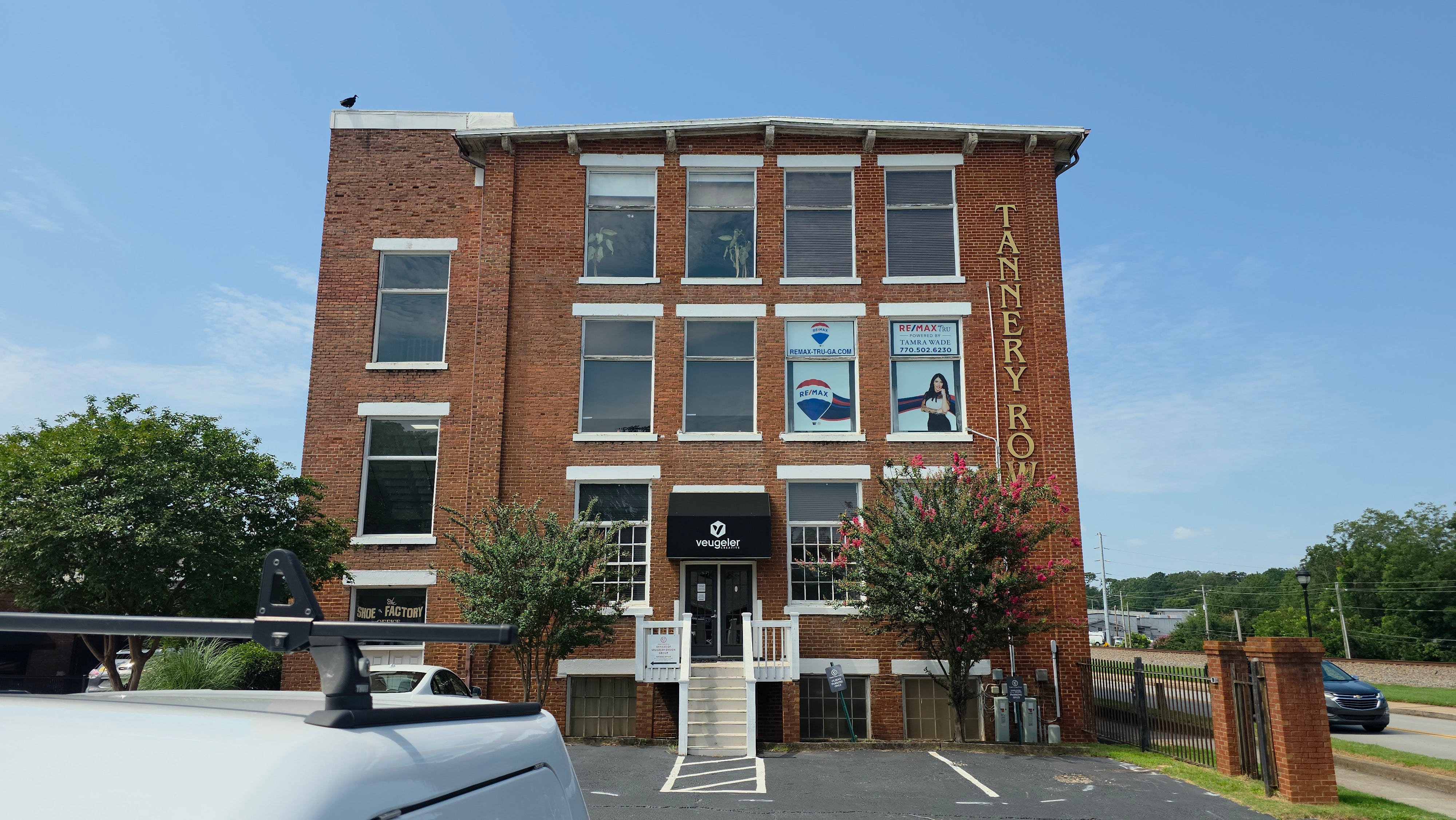
The Museum of Buford’s history of the colony traces the arrival of artists to 1984. Over time, more than 100 artists worked in Buford, drawn by affordable space, proximity to Atlanta, and the character of the old buildings. A core group eventually moved into the former shoe factory that became Tannery Row Artist Colony.
That continuity matters. The building was not frozen at the moment the factory closed. The kind of work changed, but the building kept working.
A closer look inside Tannery Row Artist Colony, housed in a former Bona Allen shoe factory.
The unscheduled Buford
Some of the best moments were not on the shot list.
At Brightside Cafe, I ordered a Strawberry Blonde Hibiscus Nitro. The staff let me sample both nitros, and I added espresso to the drink. The caffeine was useful, but the conversation mattered more. The stop gave the day a human pause between the artist colony and the long walk still ahead.
After that, I returned to the hotel to cool down, charge everything, and hydrate. The day had stopped being a tidy sequence of landmarks. It had become a chain of short expeditions supported by recovery stops. That is the part a finished travel film can hide unless you choose to leave some of the fatigue in the edit.
Dinner, distance, and knowing when to stop
Fogo de Chao was about a fifteen-minute walk from the hotel. By the time I arrived, I had already covered Main Street, the Heritage Center trails, Tannery Row, and the spaces between them.
There was a wait for a table, so I spent roughly two hours at the bar talking with Caden and Robert. I started with a Gold Rush, then had two versions of the Hibiscus Heat. Staff said jalapenos were unavailable because of a recall, so the second version used a Brazilian hot pepper. I also tried a Strawberry Hibiscus Caipirinha.
At the table, the lamb chop, bacon-wrapped steak, and picanha were the standouts. Eventually my stomach made the sensible decision for me. The Mall of Georgia portion could wait. I walked back to the hotel through the evening light, filming the bridge and roadside route as the energy of the day finally dropped away.
Those are the final two pieces of footage in the film. They are not Mall of Georgia shots. They are the walk back from Fogo de Chao.
Modern Buford, two mornings later
I photographed the Mall of Georgia section on Monday, August 17, two mornings after the main expedition. The original plan had been to return the next morning, but the captured files tell the truer version: the reset lasted longer, and the mall became a separate daylight pass.
The mall belongs to a different period of Buford’s development, but it is not disconnected from the older city. Buford grew because transportation, manufacturing, and commerce repeatedly reorganized the landscape. The mall is a newer expression of that same regional pull.
In its 1999 annual report, Simon Property Group described the Mall of Georgia as its most significant opening of that year. The 1.6-million-square-foot project included a 140,000-square-foot outdoor village, an amphitheater, and murals built around Georgia history.
The scale is the point. Downtown Buford can be crossed on foot in a focused morning. The mall announces itself through distance, parking, traffic, and monumental retail space. Putting both in the same expedition shows how many versions of Buford occupy the same map.
What the camera could not explain
The completed film does not end with Monday’s mall footage. It returns to the bridge and the walk back from Fogo on Saturday night.
That is not strict chronology. It is the emotional chronology of the expedition. The mall completes the geographic coverage, but the walk back carries the feeling I remember: heavy air, tired legs, a full stomach, equipment in hand, and the quiet satisfaction of knowing I had covered the route without ignoring what the heat was telling me.
Buford’s history is often told through large transformations: railroad, leather industry, artist reuse, suburban growth. Walking it revealed the smaller continuities. Buildings are repurposed. Roads inherit older routes. People keep making things, serving strangers, and adapting familiar places to new lives.
That was the Buford I found at ground level.
I wrote about why I keep making these stops in Just Me, My Drone, and the Road Across America. For another place that found a second life, take a look at White Dog Hill and the Beany Bar in Daylight, where an old country clubhouse and caretaker’s house became a restaurant and bar.
What old factory or industrial building in your town found a second life? Tell me about it in the comments.
If you want more field notes, short films, and expeditions through places shaped by infrastructure and time, subscribe to Drone Drifter.