


Drone Drifter | Planning information checked September 17, 2026
For the August 2, 2027 eclipse, I’d start with a landscape composition that is worth watching as the light changes. A coastline, a ridge or a broad stretch of countryside can give the viewer a sense of what totality does to a place. The next question is whether I can make that shot from a lawful, manageable flight position.
The event is a total solar eclipse, with about 6 minutes 23 seconds of totality at greatest eclipse. Most observing sites get less. That maximum is a reason to investigate the event, not a promise about the time available at your chosen location. NASA’s 2027 eclipse catalog
This is an early filming guide, with southern Spain as the first detailed planning region. The dates and broad path are known; local permissions and operating conditions need checking for the actual trip.
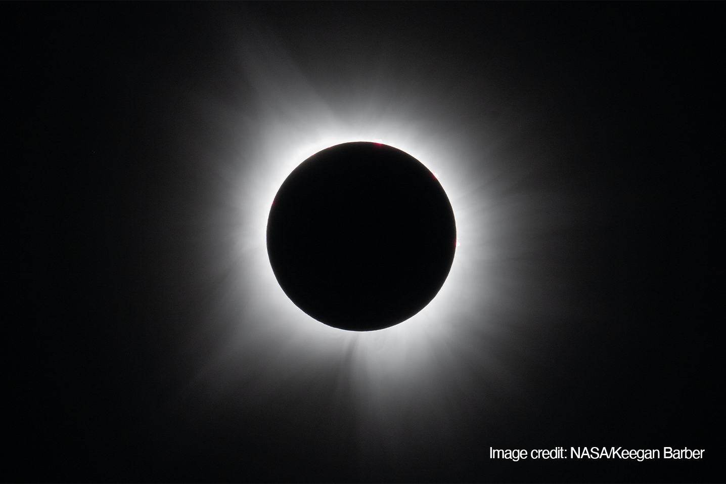
Totality in Dallas, Texas, on April 8, 2024. This historical photograph illustrates a total eclipse; it is not a photograph of the August 2027 event. Photo: NASA/Keegan Barber. Image source.
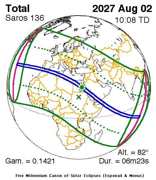
The narrow blue corridor marks the August 2, 2027 path of totality. The printed TD time is not local time, and the printed duration applies at greatest eclipse. Eclipse Predictions by Fred Espenak and Jean Meeus (NASA’s GSFC). Map source · Map key.
Start with the correct part of Spain
The 2027 eclipse crosses southern Spain around the Strait of Gibraltar. Spain’s Instituto Geográfico Nacional identifies coverage including Ceuta and Melilla, almost all of Cádiz province, part of Málaga province, and southern areas of Granada and Almería. The rest of Spain sees a partial eclipse. Do not reuse a 2026 observing location without checking the 2027 path. IGN’s August 2027 eclipse guide
I’d investigate the Cádiz and Málaga portions of the corridor first, choosing an exact camera position before making a flight plan. Look at the duration of totality, the direction of the Sun, terrain and access. Then check the airspace and land use. A town name alone does not settle any of those details.
IGN provides location-specific observing tools that account for terrain. Use those to investigate what the eclipse will look like from the ground. Treat the aerial composition as a separate exercise. IGN observing conditions
Visiting Spain with a drone
For non-EASA operators, AESA says registration is required in the first EASA member state where the operator intends to fly. If that is Spain, use Spain’s process. If already registered in another EASA state, follow the relevant cross-border requirements rather than registering twice. Training must suit the operation’s category and subcategory. AESA guidance for visiting operators
A small camera drone does not automatically remove registration requirements. EASA’s guidance includes camera-equipped drones below 250 grams unless the applicable toy exception applies. Check the actual aircraft and operation instead of relying on the word “Mini.” EASA registration guidance
Use the ENAIRE drone map to check location restrictions and alerts, alongside AESA’s current requirements for training, insurance and the type of flight. Registration is one part of preparation; it is not permission to launch anywhere.
AESA’s notice for the 2026 eclipse warned about concentrated air activity, changing light and flights over gatherings. It is useful evidence of the planning issues eclipses create, but it is not a 2027 permission or restriction notice. Recheck for current event guidance before flying. AESA’s 2026 eclipse notice
Subscribe free to Drone Drifter for updates to this guide as the 2027 arrangements become clearer.
A long eclipse does not guarantee a drone destination
Morocco is on the eclipse route, but bringing a drone requires planning beyond selecting a viewpoint. UK government travel guidance says to obtain permission from Morocco’s civil aviation authority to fly, and warns of fines and confiscation without it. Confirm entry and operating arrangements before taking the equipment. Morocco drone advice
Egypt’s official tourism information says professional camera equipment and drones must be declared and that their use requires special government permits. Do not interpret declaration at the airport as a substitute for obtaining the required permits. Egypt’s official visitor information
I’d keep a ground-camera plan as the starting point for either destination until the equipment and flight permissions are settled. The longest totality and the most practical aerial filming location may be different places. Other countries along the route need their own research; Spain’s rules do not carry across the whole eclipse path.
Give the aircraft one clear job
My first choice would be a steady landscape view with enough visible ground to show the change in light. I’d rehearse it in advance from the permitted flight area and decide whether a simple hold or a slow movement actually improves the shot.
Keep the Sun outside this landscape composition. Direct solar imaging is a separate equipment problem, especially during the partial phases. NASA advises using a suitable solar filter for those phases; removal is limited to complete totality and it must be replaced as the bright Sun reappears. That ground-camera practice is not a practical filter-changing plan for an airborne drone. NASA eclipse photography guidance
DJI warns against prolonged camera exposure to intense light sources such as the Sun. Read the manual for your model before choosing the shot. The fact that another person posted eclipse footage does not establish the suitability of your setup. DJI Mini 5 Pro manual
Rehearse the exposure change
Decide what you want the video to show. Holding one exposure can preserve the visible darkening but lose landscape detail. Automatic adjustment may retain more detail while reducing the sense of darkness or creating visible changes in brightness. Test the behavior of the actual camera before choosing.
A rehearsal under fading daylight will not reproduce the eclipse exactly. It can still reveal distracting exposure adjustments, unfamiliar controls and whether you can make the required changes while flying. Review the recorded file, not just the controller preview.
I would avoid arriving with a rigid “best eclipse settings” recipe. Write down a tested starting configuration, what you intend to change and the point at which the pilot should stop adjusting the camera and concentrate entirely on the flight.
Work backward from landing
Calculate the local start and end of totality for the exact site. Then build a timeline that includes takeoff, transit, the recording window, return and landing, with a reserve appropriate to the conditions and aircraft.
The advertised maximum flight time is not the time available to film. A pre-eclipse hover can consume the margin you need later. Decide in advance whether being airborne across totality is necessary for the story and whether the available light and operating conditions support that flight.
If you are filming alone, choose the aircraft or the ground camera as your main responsibility during the peak. My simpler plan would be to get the establishing aerial footage earlier, land and use the ground camera for totality. With a separate pilot and camera operator, agree on the division of work before the day.
Make the ground version worth shooting
A tripod sequence of the landscape, properly planned solar images, and ground-level footage of the location can carry the film if flying becomes unsuitable. Record a few details that establish where you are, and leave room for what actually happens on the day.
Keep a note of the time of each clip. If the aerial establishing shot was filmed the previous evening, do not present it as the scene during totality. Disclose composites and substantial changes to the apparent timing.
Questions to answer before departure
Can I reuse my 2026 Spain plan
Check the new path, observing times and operating arrangements from the beginning. The 2027 totality corridor covers southern Spain; a successful 2026 site does not automatically work again.
Do I get more than six minutes everywhere
No. Duration changes with location. Use the contacts for your own coordinates when planning recording and landing.
Can I fly over an eclipse gathering for a better view
Do not build a plan around that assumption. Check the rules for gatherings and uninvolved people, as well as event restrictions and the exact flight area. Choose a composition that you can capture within those limits.
What happens if the drone stays grounded
You follow the ground-camera plan. I’d rather return with a complete, carefully shot story than have the entire film depend on a launch that was never certain.
Start with the photograph or sequence you want, then work through the location and flight requirements. Once those agree, rehearse the smallest set of shots that tells the story well.
Subscribe free to Drone Drifter for eclipse filming updates, practical planning guides and the next revision of this August 2027 guide.